Take fishing to the next level
ECHOMAP™ UHD 62cv
The sunlight-readable 6” touchscreen chartplotter features a quick-release bail mount, and the transducer bundle adds Ultra High-Definition scanning sonar and CHIRP traditional sonar.
The sunlight-readable 6” touchscreen chartplotter features a quick-release bail mount, and the transducer bundle adds Ultra High-Definition scanning sonar and CHIRP traditional sonar.
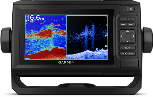 |
OPTIONAL TRANSDUCER BUNDLESelect the transducer bundle to add a GT24 transducer for Ultra High-Definition ClearVü scanning sonar, which shows you a crystal-clear image below your boat. Plus, you get Garmin high wide CHIRP traditional sonar for remarkable target separation. |
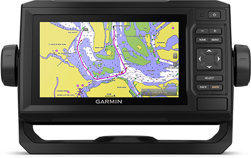 |
OPTIONAL CHARTS AND MAPSExperience unparalleled coverage and detail with support for optional BlueChart® g3 Vision coastal charts featuring integrated Garmin and Navionics® content. |
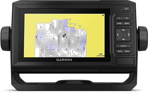 |
QUICKDRAW CONTOURSCreate personalized fishing maps on-screen with 1’ contours. Keep the data to yourself, or share it with the Quickdraw Community on Garmin Connect™. |
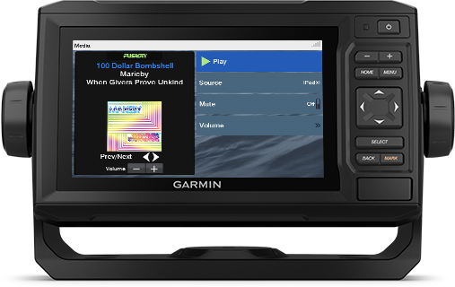 |
NMEA 2000® AND NMEA 0183 NETWORKSConnect to autopilots, digital switching, weather, FUSION-Link™ audio system, media, VHF, AIS and more from one screen. |
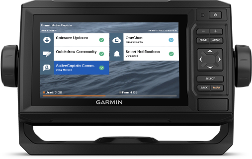 |
ACTIVECAPTAIN® APPBuilt-in Wi-Fi® connectivity pairs with the free all-in-one mobile app for access to the OneChart™ feature, smart notifications1, software updates, Garmin Quickdraw™ Community data and more.| |
| Dimensions physiques | 21.8 x 13.0 x 6.2 cm |
| Indice de résistance à l’eau | IPX7 |
| Options de montage | Sur étrier ou encastré |
| Antenne | Interne ou externe sur NMEA 2000 |
| Antenne GPS | 5 Hz |
| Format d’affichage (largeur par hauteur) | 13.7 x 7.7 cm; 15.2 cm (6.2 po) de diagonale |
| Définition d’écran (largeur par hauteur) | 480 x 800 pixels |
| Poids | 0,7 kg |
| Type d’affichage | Écran WVGA |
| Accepte les cartes mémoire | 1 carte microSD™ de 32 Go au maximum |
| Journal de suivi | 50 000 points ; 50 tracés enregistrés |
| Cartes préchargées | Fond cartographique mondial |
| Itinéraires | 100 |
| Profondeur maximum | 700 mètres à 77 kHz, eau douce
335 mètres à 77 kHz, eau salée (l’estimation de la profondeur dépend directement du type de fond et d’autres caractéristiques de l’eau) |
| Compatible télécommande sans fil | Non |
| J1939 Compatible | Non |
| Compatible avec un sondeur double fréquence | Oui |
| Puissance de transmission | 500 W (RMS) / 4 000 W (crête à crête) |
| Compatible avec XM WX Weather & Radio pour les Etats-Unis | Non |
| Polarized Support | Non |
| Journal et graphique des températures de l’eau | Oui |
| Prise en charge les radios compatibles avec FUSION-Link™ | Non |
| Consommation électrique | 12 W |
| Ports de sortie NMEA 0183 | 1 |
| Compatible NMEA 2000® | Oui |
| Verrouillage du fond (affiche la valeur du retour à partir du fond marin) | Oui |
| Compatible technologie CHIRP | Yes (Built-in) |
| Compatible NMEA 0183 | Oui |
| Nombres de broches de la sonde | 4 |
| Prise en charge de la fonction AIS (recherche la position des navires les plus proches) | Oui |
| Prise en charge du sondeur GSD™ Black Box | Non |
| Prise en charge du sondeur GCV™ Black Box | Non |
| Sonar history rewind | Oui |
| Ports d’entrée vidéo | Aucun |
| SideVü | non |
| Compatible avec ActiveCaptain | Oui |
| Compatible GRID™ (Garmin Remote Input Device) | Non |
| Prise en charge de la fonction ASN (affiche les données de position des radios VHF compatibles ASN) | Oui |
| Compatible avec les radars Garmin | Non |
| Ports du réseau Garmin Marine Network™ | Aucun |
| Fonction sondeur | Yes |
| Ports d’entrée NMEA 0183 | 1 |
| Connectivité sans fil | Oui |
| Compatible souris sans fil | Non |
| Sonar recording | Oui |
| Compatible avec un sondeur double faisceau | Oui |
| Waypoints | 5 000 |
| Compatible avec Garmin SmartMode (préréglages du moniteur personnalisables) | Non |
| Sortie vidéo | Aucun |
| Compatible avec le système audio Garmin Meteor™ | Non |
| ClearVü | Oui avec CHIRP (intégré) |
| Fonctions pour la voile | Oui |
| Tableau des marées | Oui |
You must be logged in to post a review.
Reviews
There are no reviews yet.